
Reviewed · TRONDHEIM
Discovery hike along the Trondheimsfjord
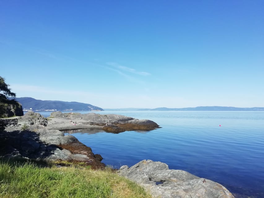
The best part of this 6-kilometer coastal walk is its mix of open fjord views, quiet beaches, and reminders of Trondheim’s past. Along the Ladestien, you move from Korsvika to Rotvoll, stopping at a German bunker, old coastal sites, and viewpoints that show a calmer side of the city.
I like the easy city connection and the way the walk links nature with local life. I also like the guide-led storytelling, which covers Trondheim’s history, World War 2, plants, wildlife, and even local politics. The main consideration is practical: this is a one-way hike of medium difficulty, not a loop, and Norwegian weather can change quickly.
Key points to know before you book
- Six kilometers from Korsvika to Rotvoll: You finish in a different part of Trondheim, so plan your return bus before setting out.
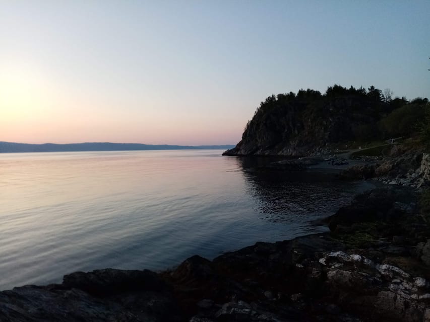
- Fjord views with real historical stops: The route includes beaches, coastal viewpoints, and the Østmarka German bunker.
- A relaxed alternative to a city tour: You spend about 2.5 hours outdoors instead of moving from one central sight to another.
- French and English guiding: The experience is offered with a live guide in either language.
- March through October departure season: Bring layers and proper footwear, since the walk runs in all kinds of outdoor conditions.
- $72 can be fair value: You are paying for a local guide, a planned route, and context you would likely miss on a self-guided walk.
Why the Ladestien is a good break from central Trondheim
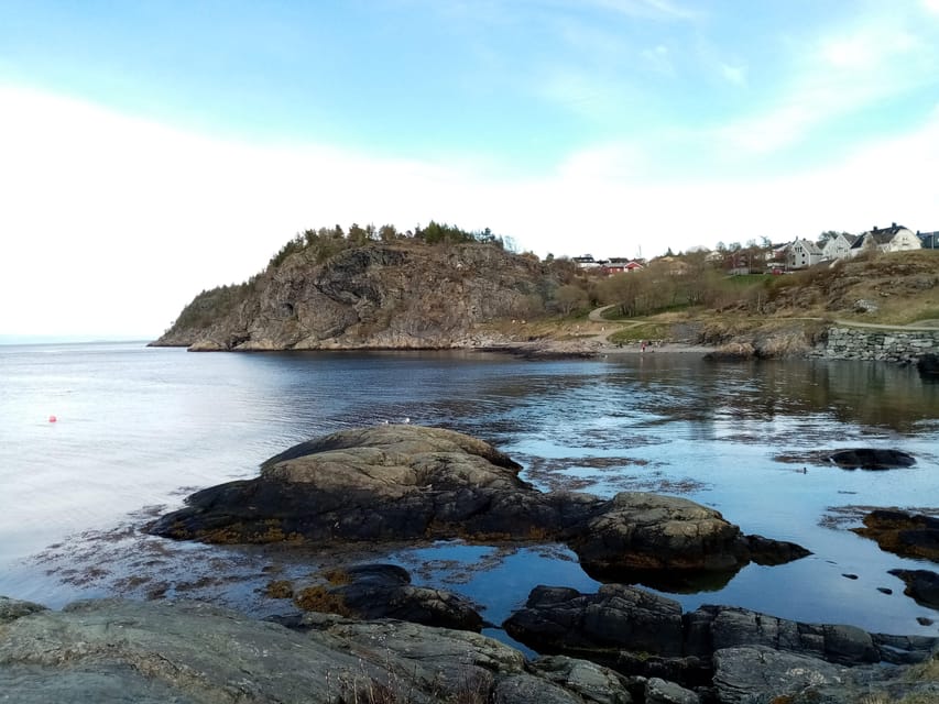
Trondheim is easy to enjoy on foot, but the city center can give you only one side of Norway. The Ladestien takes you out toward the Lade peninsula, where the pace slows and the fjord becomes the main feature.
I like this route because it does not treat nature as a backdrop only. The guide explains how the area connects to Trondheim’s past and present, while you walk beside the water and through coastal surroundings. That mix gives the outing more purpose than a simple stroll.
The walk is about 2.5 hours and covers 6 kilometers. That is enough distance to feel like you have had a proper outing, but it is still manageable for many people who are comfortable walking for a few hours. The stated difficulty is medium, so you should not approach it as a flat, effortless promenade.
The route is one way. You begin at Korsvika and finish at Rotvoll, which means you see more of the peninsula than you would on a short out-and-back walk. It also means you need to think about transport at both ends. That small bit of planning is worth it for the changing views.
More clifftop walks and viewpoints around Norway:
- Stavanger: Electric Fjord Cruise to Lysefjord & Preikestolen
★ 4.6 · 8,385 reviews - Stavanger: Fjord Cruise to Lysefjord and Pulpit Rock
★ 4.8 · 1,357 reviews - From Stavanger: Lysefjorden & Pulpit Rock RIB Boat Tour
★ 4.8 · 1,156 reviews
Starting at Korsvika and settling into the walk
The meeting point is the Korsvika parking lot. Look for the Gaël & Maëlle Travel sign, which makes the start easier to identify.
From central Trondheim, take bus number 2 toward Strindheim and get off at Ingemann Torps vei. The parking lot is about a five-minute walk from the stop. Buses run about every 10 minutes, according to the tour information, but I would still check the ATB app before leaving. The app is the official Trondheim public transport tool and lets you check times and buy tickets.
Korsvika is a useful starting point because the walk begins beside the fjord rather than with a long urban approach. You can get settled, meet the guide, and begin with coastal views almost at once.
The first moments are also a chance to judge the weather. If the sky is clear, you may get broad views across the water. If the day is gray, the shore still provides interest, but you will want a waterproof layer. The tour takes place outdoors, and the weather in Norway can shift without much warning.
Korsvika gives you the first fjord views
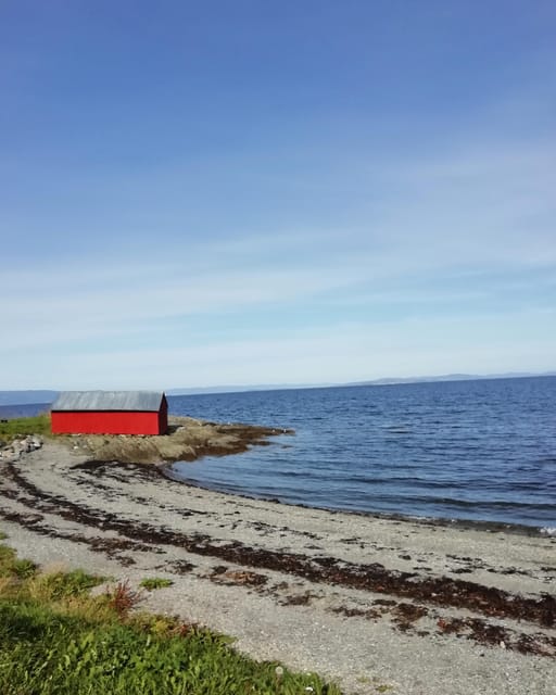
Korsvika is one of the early photo stops. This is where the walk introduces its main rhythm: move along the coast, pause at a good viewpoint, and listen to an explanation before continuing.
That rhythm suits anyone who likes to take photos without turning the whole outing into a photography session. The stops break up the walking and give you time to look out across the Trondheimsfjord.
The appeal here is simple. You are near the city, yet the setting feels more open and less built up. The route offers a useful sense of how Trondheim sits beside the water and how the coast shapes daily life around the city.
A guide adds value at this point because the view alone tells you only so much. You can see the fjord, but a local explanation helps connect the shore to Trondheim’s history and the life of the Lade peninsula.
The Østmarka bunker adds a serious historical layer
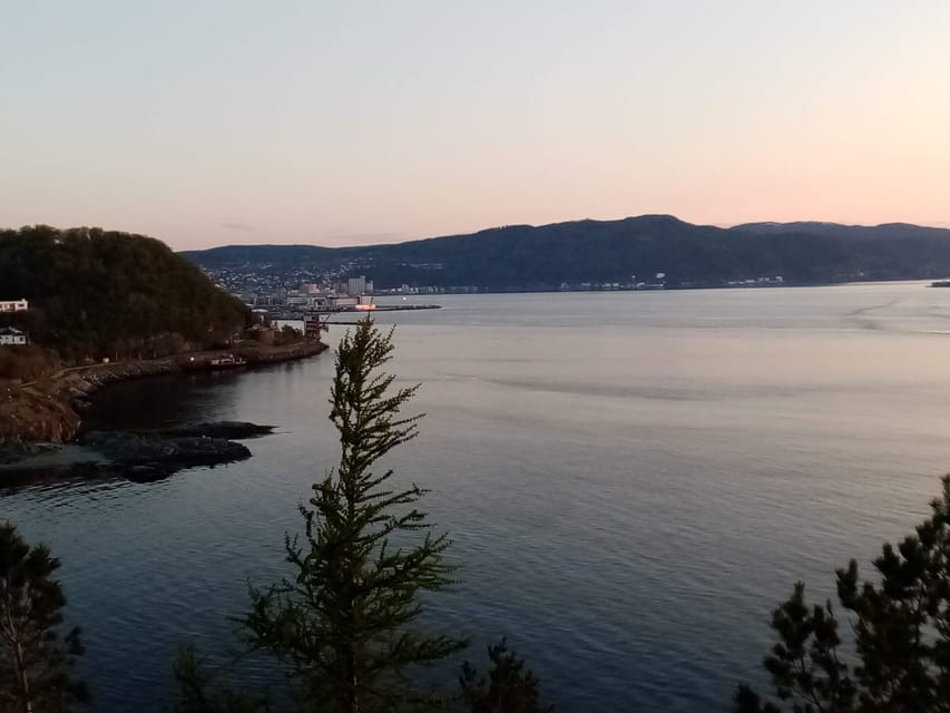
One of the most memorable stops is the German bunker at Østmarka. The remains date from World War 2 and give the walk a more serious edge.
You do not need to be a military history expert to appreciate this stop. The bunker is a physical reminder that the peaceful coast has not always been peaceful. Its presence changes how you read the surrounding area, especially after enjoying the open views and beaches.
This is one reason I prefer the guided version to simply following a path alone. The ruins can be easy to pass without much thought. With an explanation, you get context about Trondheim and the Lade peninsula during the war.
The stop also creates a good contrast in the itinerary. You move from natural scenery to a man-made remnant, then continue along the coast. That variety keeps the walk from feeling repetitive.
More hikes around Norway:
- Stavanger: Lysefjorden Cruise and Preikestolen Hike
★ 4.5 · 83 reviews - Best View of the Oslofjord Hike
★ 5.0 · 71 reviews - Fjord Hiking – Public tour
★ 5.0 · 41 reviews - Frafjord Paddling & Månafossen Waterfall Hike Stavanger
★ 5.0 · 22 reviews
Ladekaia and Sponhuset show the social side of the coast
Ladekaia is another photo stop, and it helps bring the walk back from wartime history to everyday Norwegian life. The route is not only about dramatic views. It also shows how people use the coast for walking, relaxing, and spending time outdoors.
The tour description presents the experience as a chance to feel part of a Norwegian lifestyle. That claim is best understood in a modest way. You are not visiting a staged cultural attraction. You are taking a local coastal walk, using public transport, and moving through places connected to ordinary leisure.
Sponhuset follows as another point of interest. The stop adds another change of setting and gives the guide a chance to explain more about the area. Since the walk includes several stops with commentary, you should expect the pace to be steady rather than fast.
A short café stop may be possible if the timing and route conditions allow. It is not presented as a guaranteed part of every outing, so do not book this mainly for café time. Think of it as a welcome extra on a relaxed walk.
Devlebukta brings the route toward Rotvoll
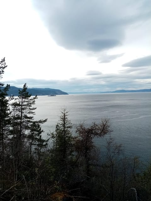
Devlebukta is one of the final listed photo stops. By this point, you have had time to settle into the route and see how the shoreline changes along the peninsula.
The value of a point like Devlebukta is not just the photo itself. It helps mark the progress of a one-way walk. You are not repeatedly seeing the same bay from the same direction. Instead, the route keeps carrying you forward toward Rotvoll.
The guide also talks about the flora and fauna of the Lade peninsula. The information supplied does not promise a wildlife sighting, so you should not expect a set animal encounter. You can, however, expect explanations about the natural life of the area as you walk.
This is a good fit if you enjoy learning small details along the way. It is less suited to someone who wants to walk quickly without stopping. The repeated photo stops and explanations are central to the experience.
Finishing at Rotvoll requires a little planning
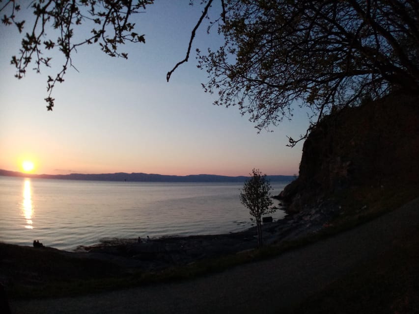
The walk finishes at Rotvoll. The bus stop is about 10 minutes from the endpoint, and bus number 20 runs toward Romolslia for the return to central Trondheim. The stated frequency is about every 15 to 30 minutes.
That final transfer is not difficult, but it is important to remember that the tour does not end where it began. If you are meeting friends later, catching a train, or working around a fixed dinner reservation, leave some extra time for the walk to the stop and the bus ride.
I recommend checking the ATB app before the tour and again near the end. Public transport is one of the strengths of this outing, but the experience works best when you treat the return journey as part of the plan rather than an afterthought.
The one-way design is still a good trade. You cover more ground and get a better sense of the peninsula. You simply give up the convenience of returning to the starting parking lot.
What the guide adds beyond the views
The guide is not there only to point out photo stops. The walk includes explanations about Trondheim’s history, the city’s past, local politics, Norwegian life, and the plants and animals of the peninsula.
Gaël is named as a guide in the experience information and in one direct account of the walk. The company, Gaël & Maëlle Travel, offers guiding in French and English. If language matters to you, confirm your preferred language when booking.
The strongest part of the guiding is the range of subjects. You can ask about the bunker, then shift to the coast, local life, or the natural setting without changing tours. One account also describes the walk continuing even with just one participant, though you should not assume every departure will be private.
The guide’s role also helps set the mood. This is described as a friendly and reassuring outing, not a hard-driving hike. You should have time to stop, listen, take pictures, and ask questions.
Is $72 a fair price?
At $72 per person, the tour is not the cheapest way to walk the Ladestien. You can explore a public coastal path on your own, and your bus tickets, food, and drinks are extra.
The price makes more sense if you value interpretation. You are paying for a local guide, a planned 6-kilometer route, historical context, and help noticing the natural details of the Lade peninsula. For someone who would otherwise walk the route without knowing what the bunker or other sites mean, that added context can justify the cost.
The tour also saves you from planning a route that begins and ends in different places. You still need to arrange your buses, but the walk itself has a clear start, finish, and sequence of stops.
I would consider it good value for a first visit to Trondheim, especially if you want a break from museums and central streets. If you are happy reading maps, walking alone, and researching the area yourself, the price may feel less attractive.
Food and drinks are not included. Bring water and anything you need for the 2.5-hour outing, particularly if you prefer not to rely on a possible café stop.
Who will enjoy this walk most
I would recommend this tour to you if you want a moderate outdoor activity that still gives you a strong connection to Trondheim. It suits people who like coastal views, history, local stories, and regular pauses.
It is also a good choice if you have already seen the main central sights and want to experience a quieter part of the city. The route offers a different view of Trondheim without requiring a full-day excursion.
You should be comfortable walking 6 kilometers over about 2.5 hours. The tour is not suitable for wheelchair users, and the medium difficulty rating means you should wear proper shoes and expect more than a completely flat city pavement walk.
Families with older children may find the format appealing, but the provided information does not give a minimum age or child-specific details. If you are booking for children, confirm that the distance and difficulty fit your group.
What to bring for Norwegian coastal weather
Wear comfortable shoes with good support. Comfortable clothing is also advised, but I would make that more specific: use layers and bring rain protection.
The tour runs from March through October, so conditions can vary greatly. A clear summer day and a cool, wet spring afternoon require different clothing. The guide cannot control the weather, and the tour remains outdoors.
Arrive on time at the Korsvika parking lot. If you are delayed, contact the provider as soon as possible. The route is one way, so joining late may be harder than joining a standard city walk.
A phone with the ATB app is useful for both the outward and return journeys. Also carry water and any snacks you want, since food and drinks are not included.
Should you book the Ladestien hike?
Book this if you want to see Trondheim from the coast, learn what you are looking at, and spend a few relaxed hours outside. The combination of fjord views, beaches, World War 2 remains, and local nature gives the outing more substance than a basic scenic walk.
Skip it if you need a fully accessible route, dislike one-way logistics, or want an intense hike with a fast pace. The route is designed around conversation and photo stops, not athletic performance.
For most visitors with the right shoes and a flexible schedule, I think the best reason to book is the balance. You get a real outdoor experience close to the city, useful local history, and a guide who can connect the pieces. Just plan the return bus, check the weather, and leave room in your day for the walk to unfold at its own pace.
FAQ
How long is the discovery hike along the Trondheimsfjord?
The walk is 6 kilometers and takes around 2.5 hours.
Where does the hike begin?
The meeting point is the Korsvika parking lot. It is about five minutes from the Ingemann Torps vei bus stop.
How do I reach Korsvika from central Trondheim?
Take bus number 2 toward Strindheim and get off at Ingemann Torps vei. You can use the ATB app for current timetables and tickets.
Where does the hike finish?
The walk finishes at Rotvoll in Trondheim. The bus stop is about 10 minutes from the endpoint.
How do I return to central Trondheim after the walk?
Take bus number 20 from Rotvoll toward Romolslia. Buses run about every 15 to 30 minutes.
What languages are available?
The live guide is available in French and English.
Is the hike suitable for wheelchair users?
No. The activity is not suitable for wheelchair users.
Fresh listings around Norway
- Fjord Houseboat Cruise in Oslo. 100 % electric. BYO★ 5.0 · 3 reviews
- 4 hours Best View of the Oslofjord Winter Edition★ 4.0 · 15 reviews
- Panoramic Peaks and Oslo’s Best Fjord Views Hike★ 3.0 · 2 reviews
- Private Oslofjord Island Hopping Tour★ 4.5 · 8 reviews
- Private tour, Bergen to Oslo – Nærøyfjord Cruise & Flåm Railway★ 5.0 · 6 reviews
- Oslo Nature walks: Forest to Fjord★ 5.0 · 9 reviews
- Oslo’s Ultimate Fjord View Hike & Norwegian Waffle Workshop★ 5.0 · 4 reviews
- Live Evening Rock Music Cruise in Oslo Fjord with Shrimp Buffet★ 5.0 · 2 reviews
Fjord Hikes and Viewpoints, compared.
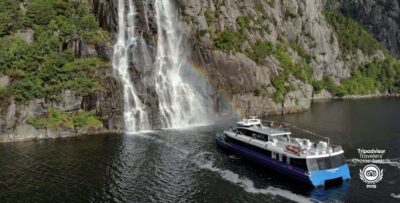
Electric Fjord Cruise to Lysefjord & Preikestolen
Read our review →

Guided Tour To Nærøyfjorden, Flåm And Stegastein – Viewpoint Cruise
Read our review →
Lysefjorden & Pulpit Rock RIB-Safari from Stavanger
Read our review →

Browse the lists this tour appears in